

Every flight becomes an air‑quality map.
A sensor backpack that clips onto any drone. Fly your route, land, and watch the map fill in — no setup, no signal needed in the air, no cloud.

Land. Plug in. It's already on the map.
The ground station finds your drones by itself and draws every flight as it arrives — one drone or a whole fleet, each in its own colour.

Nothing to configure
No Wi-Fi, no router, no pairing. Drones show up on their own; you give them a name.
Works without a signal
Every sample is saved on board for hours. The map catches up the moment the drone comes home.
Yours, on your laptop
No accounts, no cloud, no subscription. Export any flight as CSV or GeoJSON when you want it elsewhere.
Clip it on
Snaps onto the arm. Power it and the light turns green when it's ready.
Fly your route
It samples the air and tags every reading with where and when — all on its own.
Land and look
Back in range, the flight streams to the ground station and the track appears.
The payload housing
The electronics ride in a CAD-designed "backpack": a two-piece sensor box that carries the processor, environmental sensors, positioning and power as one unit, on an arm clamp shaped to the drone. The payload moves between airframes by swapping the clamp, not the electronics.
- Sensor box with a four-bolt lid and vent slots in the side wall for the air sensor
- Side-wall cutout for the board's connector, so the box stays closed in use
- Snap-over arm clamp (shown for the DJI Air 3S) bolts to the box underside
- About 74 mm across; the box itself is roughly 65 × 44 × 30 mm
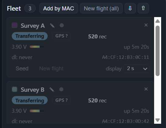
One drone or twenty.
Name each backpack, watch its battery and status from your chair, and start a fresh flight for the whole fleet with one click. Adding a new one takes a USB cable and a minute.
Put a sensor in the sky.
Air quality today; your sensor tomorrow. Tell us what you need to measure.